
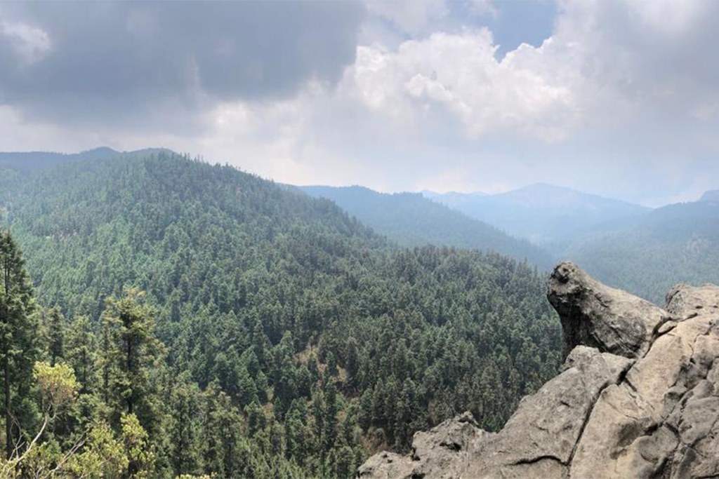
Los Dinamos, Mexico City
Puerta del Cielo
Follow the Río Magdalena through Los Dinamos toward forest viewpoints, with a route that may include via ferrata and rappelling sections.
Private treks, available on request. Full trek details, inclusions, equipment recommendations, availability and a personalized quotation are provided upon request.
Reference itinerary: 1 day
Hiking · Via ferrata · Rappelling
- Published level
- Beginner
- Route distance
- ≈ 13 km
- Route altitude
- ≈ 3,400 m
- Elevation gain
- ≈ 700 m
Reference route measurements are not a confirmed itinerary. Your proposal specifies permitted access, walking start and private group arrangements.
Overview
Puerta del Cielo brings the forests and rock formations of Los Dinamos into the same walking day. The Río Magdalena landscape provides the setting; higher viewpoints add a different perspective on the city’s mountain edge.
Published descriptions associate some routes with exposed ladders, via ferrata or rappel. Do not assume those are part of a walking booking. Exact access, route, technical supervision and equipment must be reviewed before selecting an exposed option.
- Los Dinamos mountain forest
- Río Magdalena scenery
- Rock formations and viewpoints
- Technical options reviewed separately
The route experience
Route overview
The walking experience
- Agree the permitted start and a walking or specifically assessed technical route.
- Walk selected forest and viewpoint trails. Exposed or technical sections are not assumed; your proposal identifies the actual route.
- Return to the agreed trailhead with time in reserve. Transport, meals and any equipment supply follow your written proposal.
An overview of the destination, not a fixed departure itinerary. The selected trails, walking stages and transport are set out in your personalized proposal.
Inclusions & route planning
Guiding, access, transport, meals, equipment and overnight arrangements are defined in your written quote. None are implied by this proposed route.
The published route measurements are reference data. The final walking start, difficulty, access and any additional activities are reviewed for your dates and experience.
What to bring
- Daypack with hip/chest straps (not a tote or shoulder bag)
- 1–2 litres of water
- Trail snacks: nuts, dried fruit, bars
- Hiking boots or trail shoes with ankle support and grippy soles
- Sports clothing: quick-dry shirt, jacket, hiking trousers
- ID and cash for lunch
- Warm hat and gloves
- Sunscreen, sunglasses and cap
- Rain jacket
The day before: no alcohol, a carb-rich dinner, plenty of water and a good night's sleep.
Preparation
Share your recent hiking experience, fitness and time at altitude. Train for both the climb and the descent, break in your footwear and check the final packing list for your dates. Seek medical advice for health concerns before high-altitude travel.
Safety & access
Weather, trail access and the group’s condition may change the plan. Ask for guide arrangements, emergency communication, evacuation planning and insurance requirements for your selected route. A viewpoint or summit is never guaranteed.
Planning & safety →On the trail
Trip facts
- Duration
- 1 day · reference
- Difficulty
- Beginner · reference route
- Max altitude
- Defined by the selected route
- Distance
- ≈ 13 km · reference route
- Elevation gain
- ≈ 700 m · reference route
- Price / quote
- Request a Quote
- Departures
- Private departure · on request
- Group size
- Specified in your route proposal
- Meeting point
- Set out in your trip proposal
- Guide & supervision
- Ask for the guide profile for your route
- What's included
- Only agreed services in your written quote
- What to bring
- See the packing list above
- Acclimatization requirements
- Planned around altitude and experience
- Cancellation policy
- Provided with your quote before booking