Sierra Sur to Huatulco, Oaxaca
Camino Copalita
A six-day Sierra Sur journey from high forest to the Pacific through the Copalita watershed, shaped by community knowledge and a changing mountain-to-coast landscape.
Request the full six-day Camino Copalita program. Dates and participation follow community and local-operator arrangements; a private departure is not guaranteed. Your written proposal confirms route, services and quotation.
Reference itinerary: 6 days · Oaxaca City to Huatulco
Multi-day trekking · Community program · River travel depends on conditions
- Published level
- Easy to hard
- Route altitude
- ≈ 3,750 m
Reference route measurements are not a confirmed itinerary. Your proposal specifies permitted access, walking start and private group arrangements.
Overview
Six-day community program · dates by local agreement
Operated on the ground by our partner Camino Copalita
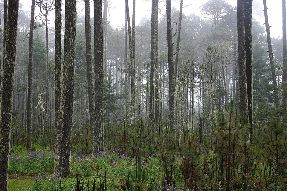
The first days belong to Oaxaca’s high forest: pine and fir, cool air and the mountain world around San Juan Ozolotepec. Then the path drops through cultivated slopes and warmer vegetation toward the Copalita River, where the Pacific becomes the final horizon.
Camino Copalita is a six-day community-guided Sierra Sur journey, not a short coastal hike. Its character comes from a watershed shared by mountain communities: forest management, milpa and coffee landscapes, local knowledge and the transition toward La Bocana near Huatulco.
The official format combines walking with river travel where conditions permit. Long descents, heat and remote terrain demand preparation. The community program is not offered here as a shortened route or a guaranteed private departure; dates, participation and final arrangements are agreed with the local operator.
- Six-day forest-to-coast journey
- Sierra Sur community knowledge
- Pine and fir to tropical vegetation
- Milpa and coffee landscapes
- Copalita watershed to La Bocana
The route experience
Route overview
Highland forests
- The reference program begins in the San Juan Ozolotepec highlands, with community forest and agricultural landscapes.
Route overview
Pine, fir and cultivated slopes
- Walking connects high forest with the landscapes of milpa and coffee. The selected stage and visits follow the community program.
Route overview
The long descent
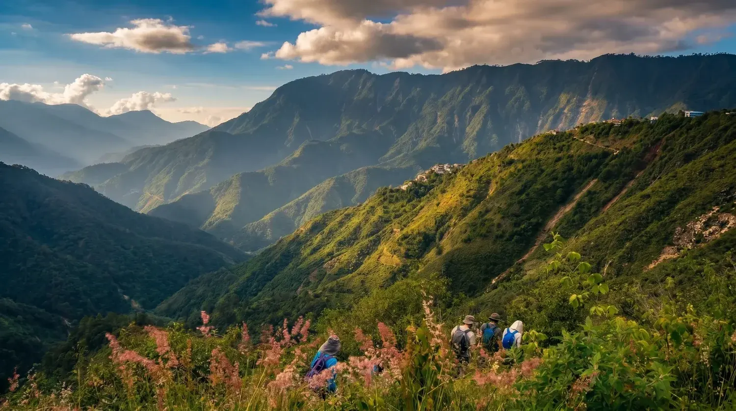
- A demanding descent leads toward warmer canyon country. River levels, weather and the group’s condition determine crossings and pace.
Route overview
Following the watershed
- River-edge trails introduce a warmer landscape. Camp locations and any visits are specified in the locally agreed itinerary.
Route overview
Tropical forest and local knowledge
- The published program continues through lower-elevation forest and community landscapes, with botanical experiences dependent on hosts and conditions.
Route overview
The Pacific horizon
- The journey reaches the La Bocana area near Huatulco. River travel depends on water conditions; no rafting distance, swim or precise arrival time is guaranteed.
An overview of the destination, not a fixed departure itinerary. The selected trails, walking stages and transport are set out in your personalized proposal.
Inclusions & route planning
Guiding, access, transport, meals, equipment and overnight arrangements are defined in your written quote. None are implied by this proposed route.
The official program is six days and is not marketed as a shorter route. Community dates, the final daily stages, river travel, luggage support, lodging and all included services need agreement in writing.
Official pages differ on total distance. We do not state a combined walking-and-river total; ask for the current daily walking plan.
What to bring
- Grippy walking footwear and river footwear appropriate to the confirmed route
- Quick-drying clothing, rain protection and warm layers for the highlands
- Sun protection and the agreed water-carrying capacity
- Daypack, overnight bag and sleeping system reviewed with the operator
The day before: no alcohol, a carb-rich dinner, plenty of water and a good night's sleep.
Preparation
Share your recent hiking experience, fitness and time at altitude. Train for both the climb and the descent, break in your footwear and check the final packing list for your dates. Seek medical advice for health concerns before high-altitude travel.
Safety & access
Weather, trail access and the group’s condition may change the plan. Ask for guide arrangements, emergency communication, evacuation planning and insurance requirements for your selected route. A viewpoint or summit is never guaranteed.
Planning & safety →On the trail
Photos and route: Camino Copalita
About this place
- Follows the Copalita River watershed, which reaches the coast near Huatulco.
Trip facts
- Duration
- Six-day community program · dates by local agreement
- Difficulty
- Easy to hard · reference route
- Max altitude
- ≈ 3,750 m
- Elevation gain
- Defined by the selected walking stages
- Price / quote
- Request a Quote
- Departures
- Private departure · on request
- Group size
- Specified in your route proposal
- Meeting point
- Set out in your trip proposal
- Guide & supervision
- Ask for the guide profile for your route
- What's included
- Only agreed services in your written quote
- What to bring
- See the packing list above
- Acclimatization requirements
- Planned around altitude and experience
- Cancellation policy
- Provided with your quote before booking