Guide · November 9, 2026 · 7 min read
Best Hikes in Mexico: A Practical Guide to Three Volcanic Adventures
The best hikes in Mexico are not all about reaching the highest summit. Compare Iztaccíhuatl, Nevado de Toluca and Paricutín by landscape, preparation and the questions to ask before committing to a route.
A ridgeline traces the shape of the Sleeping Woman. Lagoons sit within a volcanic crater. Lava fields lead toward a volcano whose story began in a cornfield. Searching for the best hikes in Mexico brings these very different landscapes into the same conversation, but choosing between them requires more than a compelling photograph. This guide compares three Backpacking Mexico trips: Iztaccíhuatl Summit, Nevado de Toluca Summit and Paricutín Volcano. Rather than declaring one universal winner, it helps you decide what you want from the walk, recognize what the trip descriptions actually establish, and ask for the missing details before making plans.
Which hike is best for the experience you want?
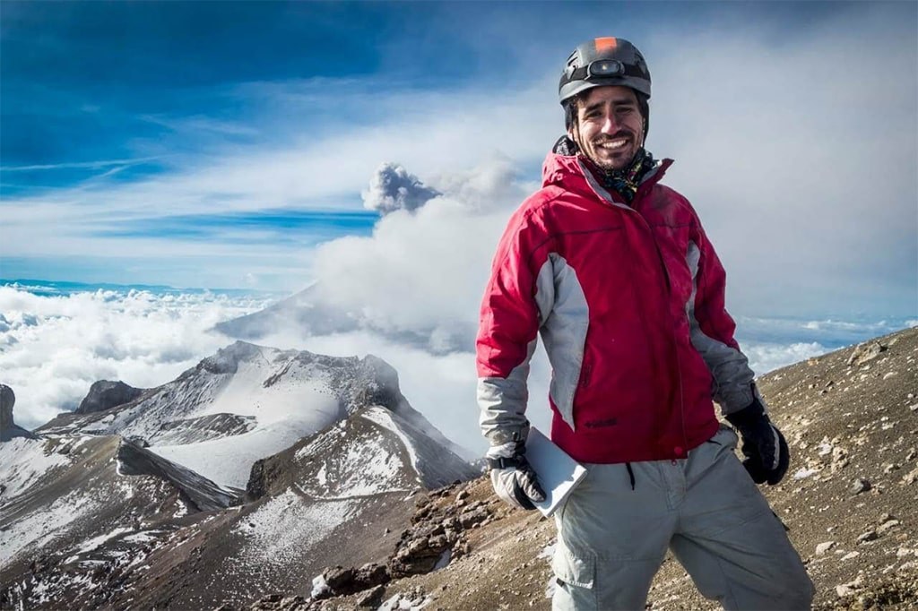
Iztaccíhuatl Summit is the choice to investigate when a demanding high-mountain journey is the central ambition. The catalogue places it in the State of Mexico / Puebla and describes a route along the ridgeline of the Sleeping Woman, intended for well-prepared hikers. Its listed maximum altitude is 5,230 meters. Those details give the trip a clear identity without supplying a complete itinerary. Ask Backpacking Mexico what preparation this particular outing requires and how your experience matches the proposed route. The attraction is the mountain journey itself; treat the summit as an objective to discuss, not a result to assume when booking.
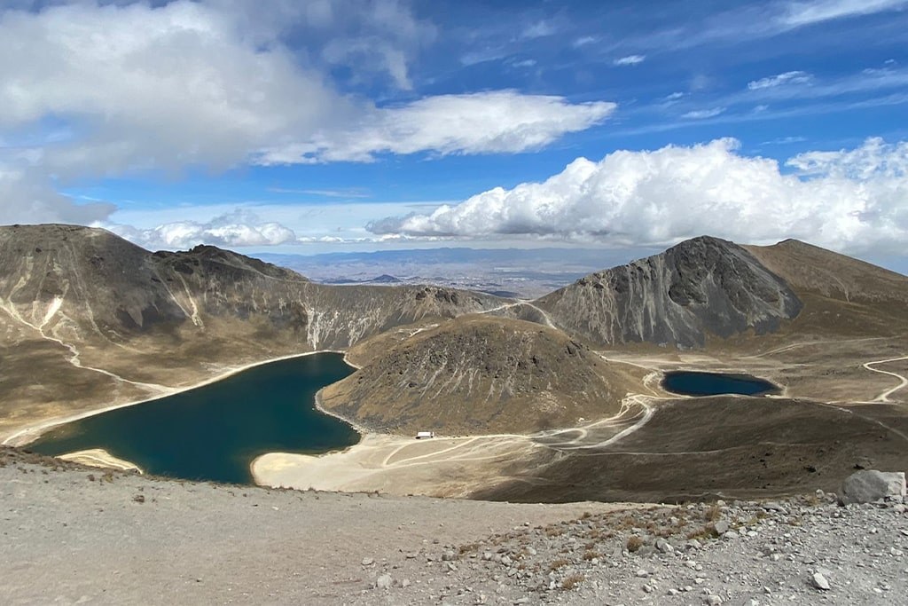
Nevado de Toluca Summit offers a different focus: a high-altitude day out among crater rims and the Sun and Moon lagoons in the State of Mexico. The listed maximum altitude is 4,680 meters. If the relationship between water and volcanic landforms is what draws you outdoors, this is a trip worth exploring. Be precise about the name when enquiring, however: the experience discussed here is the summit trip, not a promise of a lakeside-only walk. Ask which parts of the crater landscape feature in the proposed itinerary, what the summit objective involves, and how much walking the actual plan includes.
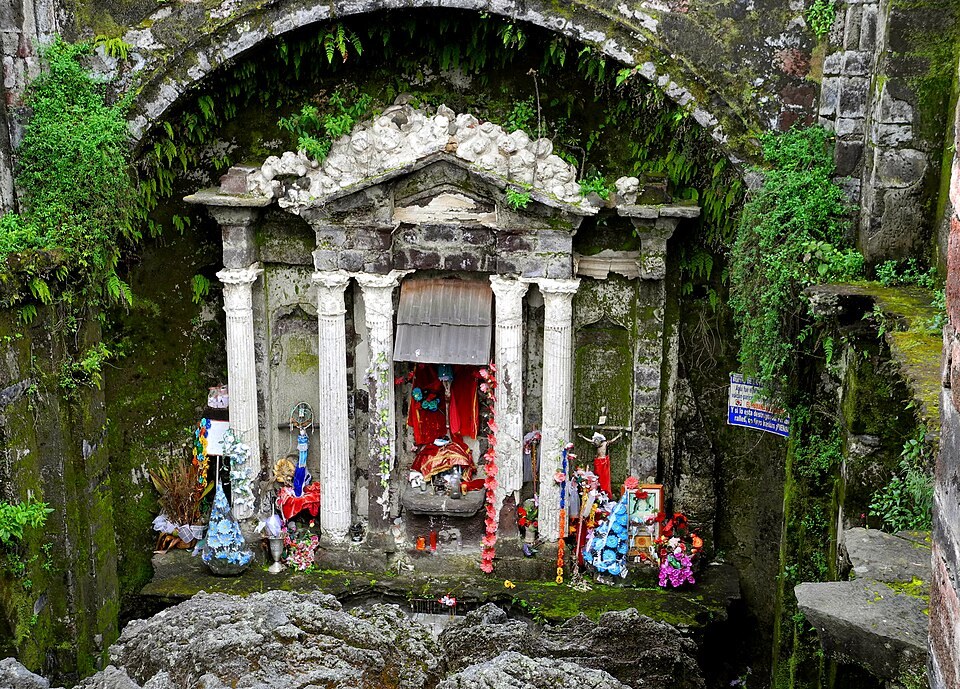
Paricutín Volcano, in Michoacán, turns the walk toward the story of a changing landscape. The catalogue describes hiking across lava fields to a volcano born in a cornfield in 1943, passing the buried church of San Juan Parangaricutiro. Here, the strongest reason to choose the trip may be that connection between volcanic terrain and a human landmark, rather than a particular altitude. No maximum elevation, distance or walking time is supplied. Ask Backpacking Mexico to explain the intended route and its demands before treating Paricutín as the easier alternative. A different kind of landscape does not, by itself, establish a difficulty rating.
The best hike is not necessarily the highest one; it is the journey whose demands and purpose match your preparation.
How hard are these hikes, and how long do they take?
Only Iztaccíhuatl is explicitly described as demanding and intended for well-prepared hikers. None of these three listings supplies a formal difficulty grade or a distance, and none provides an exact walking duration. Nevado de Toluca is described as a day out, but that is not an hourly schedule. Avoid filling these gaps with estimates borrowed from another itinerary carrying the same mountain name. Instead, request the planned distance, elevation gain, expected walking time and terrain description for the specific departure you are considering. These are questions for the organizer, not figures that can responsibly be inferred from a summit elevation.
Make the difficulty conversation personal and concrete. Tell Backpacking Mexico about recent hikes you have completed, the loads you carried, your comfort on uneven ground and any previous experience at altitude. Describe how those outings felt rather than relying only on labels such as beginner or intermediate. Then ask what experience the proposed trip expects, how the group’s pace is managed, and what happens if continuing no longer fits the situation. For Iztaccíhuatl, address the catalogue’s well-prepared requirement directly. For Nevado de Toluca and Paricutín, ask for an assessment rather than assuming that the absence of a difficulty label means an undemanding walk.
How do you get there and organize the approach?
Start with the regions, then obtain an actual meeting plan. Iztaccíhuatl is listed in the State of Mexico / Puebla, Nevado de Toluca in the State of Mexico, and Paricutín in Michoacán. The catalogue does not specify trailheads, driving directions, transport arrangements or transfer times for these trips. Ask Backpacking Mexico for the exact meeting location, whether transport is included or arranged separately, and where the guided portion begins and ends. Clarify any access arrangements and the expected return plan before committing to onward travel. A regional label helps orient your research, but it should never stand in for instructions for reaching the hike.
What should you bring?
Build your packing list around the confirmed itinerary rather than a generic summit photograph. Ask for a route-specific list covering footwear, clothing layers, protection from sun and precipitation, food, drinking water and a suitable backpack. Clarify which items you must bring and which, if any, the operator supplies. For Iztaccíhuatl and Nevado de Toluca, ask explicitly whether the proposed outing requires specialized equipment or prior training; the short descriptions do not settle that question. For Paricutín, request footwear guidance for the planned lava-field walk. Treat these as preparation prompts, not a complete equipment prescription or confirmation that any item is included.
How should you plan for altitude and acclimatization?
The altitude figures deserve attention, but they need to be read correctly. Iztaccíhuatl Summit lists a maximum of 5,230 meters, while Nevado de Toluca Summit lists 4,680 meters. These are maximum-altitude figures, not starting elevations or amounts of ascent. They also do not reveal how long an itinerary spends at particular elevations. Paricutín has no altitude figure in the supplied listing, so this guide does not assign one. Ask for the elevation profile of your proposed outing and discuss how it fits your recent travel and hiking history. Comparing two maximum numbers is only the beginning of a useful preparation conversation.
Before building a tight travel schedule around a summit attempt, ask Backpacking Mexico how acclimatization should fit into your plan. Explain where you will be coming from, your prior altitude experience and any previous difficulties, rather than requesting a universal number of preparation days. The catalogue does not prescribe an acclimatization schedule for these trips, and this guide cannot supply a personal medical assessment. Seek advice from a qualified healthcare professional about individual health concerns. Also ask the organizer how concerns during the outing are communicated and what the plan is if the objective changes. Preparation should leave room for decisions, not merely create pressure to finish.
When is the best season to go?
There is no supported best-month ranking for these three hikes in the catalogue. It provides neither seasonal operating windows nor monthly descriptions of weather or trail conditions. Rather than turning a broad travel assumption into a recommendation, ask Backpacking Mexico which trip is appropriate for your intended travel period and what needs checking closer to departure. Request clarification on how conditions and permitted access affect the proposed plan, and how changes are communicated. If your dates are fixed, explain that early and remain open to discussing the objective. If the mountain is your priority, ask how much flexibility the planning process calls for.
Frequently asked questions: which trip should you choose?
Which is best for a first hiking trip? The listings do not establish a beginner-friendly winner, so request an individual assessment before choosing. Which has the highest listed altitude? Among these three, Iztaccíhuatl Summit, at 5,230 meters. Which should you investigate for crater lagoons? Nevado de Toluca Summit, while confirming the precise summit itinerary. Which centers a volcanic origin story and a buried church? Paricutín Volcano. These distinctions are more useful than an unsupported overall ranking. They separate the experience you hope to have from the physical requirements you still need to verify, giving your first conversation with the organizer a clear direction.
Can you compare value or book solely from this guide? No prices, inclusions or availability are established here, so request a current proposal before making commitments. Can you combine the hikes into one itinerary? Ask Backpacking Mexico rather than assuming that regional proximity, transfer arrangements or preparation needs make a particular sequence workable. Begin with the trip that most strongly matches your purpose: Iztaccíhuatl Summit for its demanding ridgeline journey, Nevado de Toluca Summit for its crater setting, or Paricutín Volcano for lava fields and the buried church. Then let the confirmed route, your experience and a realistic preparation plan determine the choice.