Guide · October 19, 2026 · 8 min read
Hiking in Mexico City: How to Choose and Prepare for Your Walk
From Ajusco’s forested summit to Xitle’s volcanic terrain and Cerro San Miguel’s summit hermitage, Mexico City offers different reasons to walk. Use this guide to compare the experiences, ask the right questions, and prepare without relying on unsupported route assumptions.
What does hiking in Mexico City look like?
Hiking in Mexico City starts with a choice of landscape, not a competition for the highest summit. The catalogue offers three distinct invitations: a forested ascent on Ajusco, volcanic terrain at Volcán Xitle, and a climb through the forests of Desierto de los Leones on Cerro San Miguel. Each gives a different focus to a day outdoors. You might be drawn to a crater, a summit hermitage, or the idea of reaching the city’s highest point. Before asking which hike is best, consider what you want to notice along the way and what kind of walking experience you want to have.
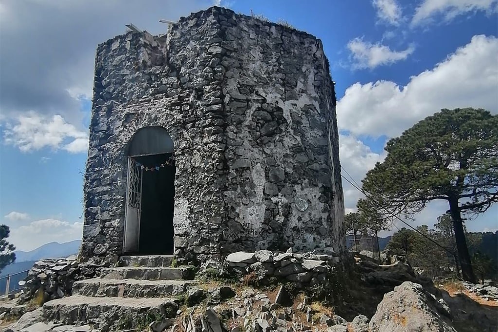
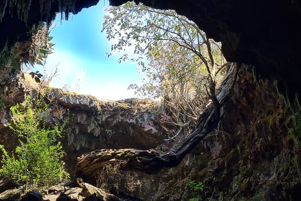
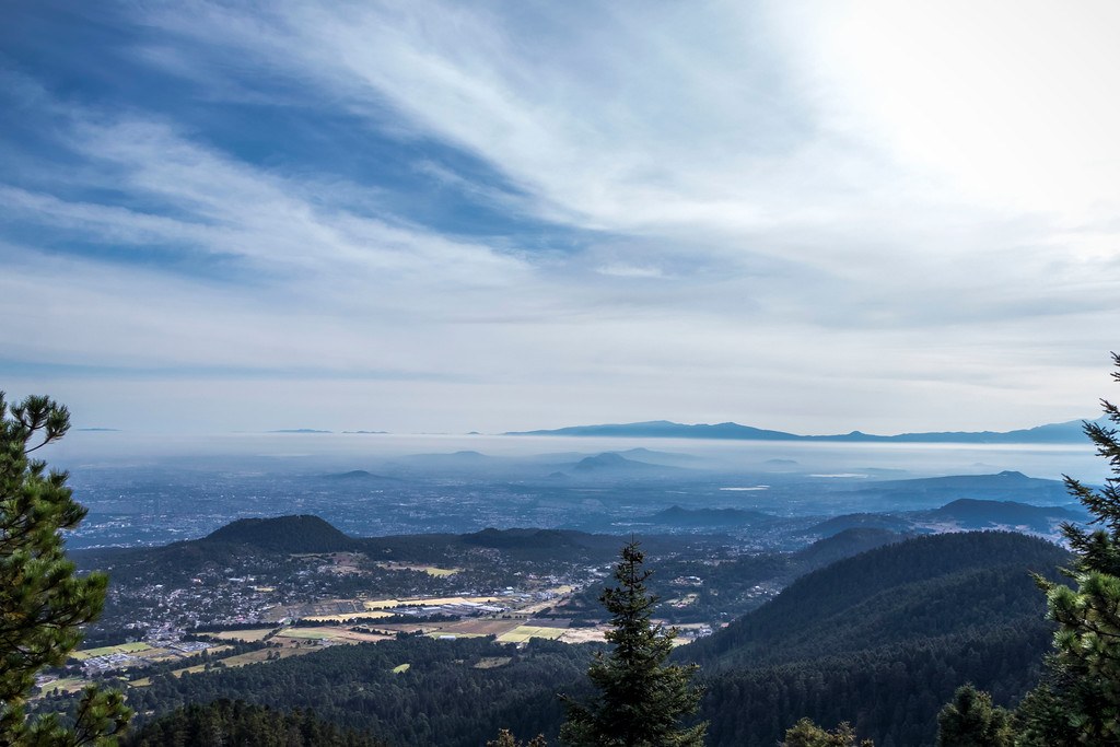
Ajusco is described as a forested summit hike close to the capital, with a maximum altitude of 3,930 meters and a day-hike format. Volcán Xitle, in the Ajusco area on the city’s southern edge, combines forest trails with volcanic terrain, a crater, and lava-formed caves. Cerro San Miguel climbs through Desierto de los Leones toward a summit hermitage and broad views across the mountains surrounding Mexico City. These descriptions help you choose a theme, but they do not establish a ranking by effort. Ask Backpacking Mexico about all three, then compare the specific itinerary proposed for your group before committing.
How difficult are Ajusco, Xitle, and Cerro San Miguel?
None of these three catalogue entries gives a difficulty grade or a distance. Ajusco’s day-hike designation describes the outing’s format, not the number of hours spent walking, and the other two entries provide no duration. That makes labels such as easy, intermediate, or suitable for everyone inappropriate here. A useful comparison needs more than a destination name: request the planned distance, cumulative ascent, expected walking time, terrain description, and approach to breaks. For Volcán Xitle, also ask which crater or cave features are included in the proposed outing. A catalogue description should not be mistaken for a detailed, confirmed route plan.
Give the guide concrete information about yourself rather than simply saying you are fit or inexperienced. Describe your recent walks, how you felt during sustained uphill sections, and whether carrying a pack or walking downhill caused discomfort. Explain what the rest of your group wants from the outing, especially if experience levels differ. Someone seeking time to observe volcanic features may have different priorities from someone focused on a summit. Ask Backpacking Mexico how the proposed pace and objectives match that background. If you are planning a first hike, say so explicitly; the catalogue alone cannot establish which option is appropriate for you.
Choose the walk for the experience you want, then check that the plan fits the experience you bring.
How do you get there and organize the return?
The catalogue locates Ajusco in Mexico City, Volcán Xitle in the Ajusco area, and Cerro San Miguel in Desierto de los Leones. It does not identify trailheads, meeting points, driving directions, or public transport connections. Treat those omissions as questions to resolve, not gaps to fill with assumptions. Before arranging your journey, request the exact meeting location and clarify whether it is also the starting point of the walk. Ask how the group reaches the trail and whether transportation is included or arranged separately. A shared place name does not tell you which access point your guide intends to use.
Plan the return with the same care as the departure. Ask where the outing finishes, how the return transfer works, and what time window you should keep free. Separate walking time from the full time commitment, including transfers and any planned pauses. If you intend to travel independently, confirm where you should arrive and how you will leave rather than relying on an unverified map pin. Request any access instructions that apply to the proposed outing. Backpacking Mexico can be asked to clarify these arrangements before you book; do not assume that a guided hike automatically includes every part of the journey.
What should you bring?
Build your packing list around the confirmed itinerary rather than a generic image of mountain adventure. As general preparation, consider footwear you have already walked in, a comfortable backpack, clothing layers, rain protection, sun protection, drinking water, and food you know you tolerate while active. These are planning suggestions, not an official equipment list for any of the three hikes. Ask the operator what is required, what is supplied, and what remains your responsibility. In particular, request guidance on water and food quantities once the expected duration and outing conditions are clear, instead of borrowing amounts from an unrelated route.
Volcán Xitle’s lava-formed caves make it especially important to distinguish the landscape description from the day’s actual activities. Ask whether the planned itinerary includes entering a cave and whether that changes the equipment requirements. Do not assume that technical equipment is needed, provided, or unnecessary without confirmation. Apply the same habit to Ajusco and Cerro San Miguel: understand the proposed walk before buying specialized gear. Pack so that essential items are easy to reach, and test the comfort of your loaded backpack beforehand. The goal is not to carry the most equipment, but to bring what the confirmed plan calls for.
What about altitude and acclimatization?
Ajusco has a stated maximum altitude of 3,930 meters, the only maximum elevation supplied for these three outings. Its description as the highest point in Mexico City is a reason to ask specific preparation questions, not a reason to treat the summit as obligatory. The catalogue does not state the starting altitude, cumulative elevation gain, or time spent at higher elevations. Nor does it provide maximum altitudes for Volcán Xitle or Cerro San Miguel. Avoid using the missing figures to declare either one an acclimatization hike. Ask Backpacking Mexico what preparation is appropriate for the particular itinerary being considered.
Discuss your recent altitude exposure, arrival plans, and previous mountain experience when you enquire. If you have concerns about altitude or a medical condition that may affect participation, seek individualized advice from a qualified health professional. This guide cannot prescribe an acclimatization schedule or certify that a particular walker is ready. Ask the operator how it approaches pacing, communication, and changes to the objective if someone feels unwell. Agree that you will report discomfort rather than conceal it to keep the group moving. A summit photograph should never become a promise you feel compelled to fulfill regardless of how the outing develops.
What is the best season for hiking here?
The catalogue does not specify a best season for Ajusco, Volcán Xitle, or Cerro San Miguel. It also provides no month-by-month conditions or operating calendar. Naming a universally ideal month would therefore suggest knowledge these descriptions do not contain. Instead, ask Backpacking Mexico whether your preferred period suits the intended outing and what conditions could lead to a change of plan. Consult a current forecast as departure approaches and request updated guidance from the operator. An evergreen guide can help you prepare those questions, but it cannot replace information tied to the time and circumstances of your actual walk.
Think about what would still make the experience worthwhile if your preferred outcome changed. Cerro San Miguel’s description includes broad mountain views, but a landscape description is not a visibility guarantee. Ajusco’s summit focus does not make reaching the top a condition of a meaningful outing, and Xitle’s crater and caves should be discussed as itinerary features rather than assumed promises. Ask how the operator communicates adjustments and what booking conditions apply if the plan changes. That conversation helps align expectations without inventing seasonal advantages, guaranteed scenery, or assurances about access that the catalogue does not provide for these hikes.
Frequently asked questions: which hike should you choose?
Which is best for beginners? The available entries do not support naming a winner; suitability depends on the confirmed route and your background. Which is shortest? Distances and walking hours are not supplied. Can you plan Ajusco as a day hike? Yes, that is its catalogue format, although the detailed schedule still needs confirmation. Which option emphasizes volcanic features? Volcán Xitle, with its crater, lava-formed caves, forest trails, and volcanic terrain. Which includes a summit hermitage? Cerro San Miguel. These distinctions are useful because they compare what is actually described, without turning an appealing landscape into an unsupported claim about ease.
Do you need a guide, and what will the outing cost? The catalogue does not establish guide requirements, prices, inclusions, or availability, so request those details directly rather than assuming an answer. A productive message to Backpacking Mexico might explain your recent walking experience, group size, preferred period, and interest in Ajusco, Volcán Xitle, or Cerro San Miguel. Ask which proposed itinerary fits those priorities and request its practical details in writing. The choice then becomes clearer: not the most impressive name on a list, but a walk whose landscape appeals to you and whose plan you understand before leaving.